Fájl:1800 Wilkinson Map of the 4 Eastern Churches rectified.jpg

Eredeti fájl (1 678 × 1 308 képpont, fájlméret: 895 KB, MIME-típus: image/jpeg)
|
Ez a fájl a Wikimedia Commonsból származik. Az alább látható leírás az ottani dokumentációjának másolata. A Commons projekt szabad licencű kép- és multimédiatár. Segíts te is az építésében! |
| Leírás |
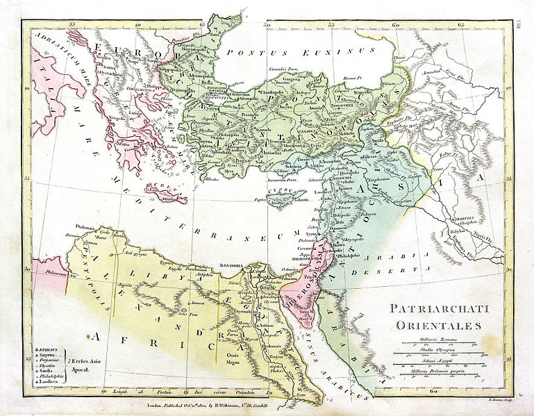
English: Map of the 4 Eastern Churches in the Pentarchy, circa 500CE |
| Dátum | (UTC) |
| Forrás | |
| Szerző |
Az eredeti feltöltő Fredrick Wilhelm a(z) angol Wikipédia projektből volt
|
| Ez egy retusált kép, ami azt jelenti, hogy az eredetihez képest digitálisan módosították. Módosítások: Rectified, cropped, colors corrected. Az eredeti itt található: 1800 Wilkinson Map of the 4 Eastern Churches.jpg. Módosította: MichaelBueker.
|
|
Ez a mű közkincs abban az országban, ahol elkészítették, és minden olyan további államban, ahol a szerzői jogi védelmi idő a szerző élete plusz 70 év vagy kevesebb.
| |
| Megállapították, hogy ez a fájl mentes mindenféle szerzői jogi korlátozástól, beleértve az összes kapcsolódó és hozzátartozó jogot. | |
Eredeti feltöltési napló
This image is a derivative work of the following images:
- File:1800_Wilkinson_Map_of_the_4_Eastern_Churches.jpg licensed with Cc-pd-mark-footer, PD-old
- 2010-08-24T08:50:03Z File Upload Bot (Magnus Manske) 1802x1378 (2039705 Bytes) {{BotMoveToCommons|en.wikipedia|year={{subst:CURRENTYEAR}}|month={{subst:CURRENTMONTHNAME}}|day={{subst:CURRENTDAY}}}} {{Information |Description={{en|Map of the 4 Eastern Churches in the Pentarchy, circa 500CE}} |Source=Tra
Uploaded with derivativeFX
Fájltörténet
Kattints egy időpontra, hogy a fájl akkori állapotát láthasd.
| Dátum/idő | Bélyegkép | Felbontás | Feltöltő | Megjegyzés | |
|---|---|---|---|---|---|
| aktuális | 2016. február 10., 22:47 | | 1 678 × 1 308 (895 KB) | Чръный человек | обработка |
| 2016. február 9., 20:04 |  | 1 678 × 1 308 (1,22 MB) | Чръный человек | Осветление | |
| 2011. május 1., 22:29 |  | 1 678 × 1 308 (1,91 MB) | MichaelBueker | color touchup | |
| 2011. május 1., 22:14 |  | 1 678 × 1 308 (1,61 MB) | MichaelBueker | {{Information |Description={{en|Map of the 4 Eastern Churches in the Pentarchy, circa 500CE}} |Source=*File:1800_Wilkinson_Map_of_the_4_Eastern_Churches.jpg |Date=2011-05-01 20:13 (UTC) |Author=*[[:File:1800_Wilkinson_Map_of_the_4_Eastern_Churches.j |
Fájlhasználat
Az alábbi lap használja ezt a fájlt:
Globális fájlhasználat
A következő wikik használják ezt a fájlt:
- Használata itt: ar.wikipedia.org
- Használata itt: arz.wikipedia.org
- Használata itt: az.wikipedia.org
- Használata itt: bg.wikipedia.org
- Használata itt: bn.wikipedia.org
- Használata itt: ckb.wikipedia.org
- Használata itt: cs.wikipedia.org
- Használata itt: el.wikipedia.org
- Használata itt: en.wikipedia.org
- Használata itt: eo.wikipedia.org
- Használata itt: es.wikipedia.org
- Használata itt: fa.wikipedia.org
- Használata itt: fr.wikipedia.org
- Használata itt: id.wikipedia.org
- Használata itt: it.wikipedia.org
- Használata itt: ko.wikipedia.org
- Használata itt: mk.wikipedia.org
- Használata itt: ml.wikipedia.org
- Használata itt: pt.wikipedia.org
- Használata itt: ru.wikipedia.org
- Használata itt: sk.wikipedia.org
- Használata itt: sr.wikipedia.org
- Használata itt: sv.wikipedia.org
- Használata itt: tr.wikipedia.org
- Használata itt: uk.wikipedia.org
- Használata itt: zh-min-nan.wikipedia.org
A fájl globális használatának megtekintése