Fájl:ACsEV rot.png
Eredeti fájl (1 567 × 911 képpont, fájlméret: 3,62 MB, MIME-típus: image/png)
|
Ez a fájl a Wikimedia Commonsból származik. Az alább látható leírás az ottani dokumentációjának másolata. A Commons projekt szabad licencű kép- és multimédiatár. Segíts te is az építésében! |
Összefoglaló
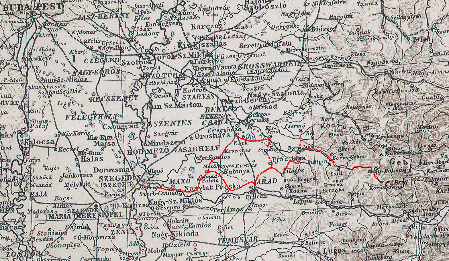
| Leírás | Cut of the map of Austria-Hungary from Andrées Hand-Atlas 1890, ACsEV (United Arad and Csanád Railways) marked in red by me |
| Dátum | original print: 1890, original upload 13:11, 7 July 2008 by User:Matriosa |
| Forrás | File:Osterreich-Ungarn.jpg |
| Szerző | original: unknown, adaption and reload: Ulamm (talk) 02:37, 9 December 2012 (UTC) + (after adding one branch) Ulamm (talk) 14:12, 30 December 2012 (UTC) |
Licenc
|
Ez a mű közkincs abban az országban, ahol elkészítették, és minden olyan további államban, ahol a szerzői jogi védelmi idő a szerző élete plusz 70 év vagy kevesebb.
| |
| Megállapították, hogy ez a fájl mentes mindenféle szerzői jogi korlátozástól, beleértve az összes kapcsolódó és hozzátartozó jogot. | |
Fájltörténet
Kattints egy időpontra, hogy a fájl akkori állapotát láthasd.
| Dátum/idő | Bélyegkép | Felbontás | Feltöltő | Megjegyzés | |
|---|---|---|---|---|---|
| aktuális | 2012. december 30., 16:09 | | 1 567 × 911 (3,62 MB) | Ulamm | {{Information |Description=Cut of the map of Austria-Hungary from Andrées Hand-Atlas 1890, ACsEV (United Arad and Csanád Railways) marked in red by me |Source=File:Osterreich-Ungarn.jpg |Date=original print: 1890, original upload 13:11, 7 July 2... |
| 2012. december 9., 04:37 |  | 1 567 × 911 (3,62 MB) | Ulamm | {{Information |Description=Cut of the map of Austria-Hungary from Andrées Hand-Atlas 1890, ACsEV (United Arad and Csanád Railways) marked in red by me |Source=File:Osterreich-Ungarn.jpg |Date=original print: 1890, original upload 13:11, 7 July 2... |
Fájlhasználat
Az alábbi lap használja ezt a fájlt:
Globális fájlhasználat
A következő wikik használják ezt a fájlt:
- Használata itt: de.wikipedia.org
- Használata itt: en.wikipedia.org
- Használata itt: ro.wikipedia.org