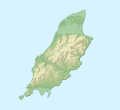
Fájl:Isle of Man relief location map.svg

Ennek a(z) SVG fájlnak ezen PNG formátumú előnézete: 654 × 600 képpont. További felbontások: 262 × 240 képpont | 524 × 480 képpont | 838 × 768 képpont | 1 117 × 1 024 képpont | 2 234 × 2 048 képpont | 1 200 × 1 100 képpont.
Eredeti fájl (SVG fájl, névlegesen 1 200 × 1 100 képpont, fájlméret: 340 KB)
Fájltörténet
Kattints egy időpontra, hogy a fájl akkori állapotát láthasd.
| Dátum/idő | Bélyegkép | Felbontás | Feltöltő | Megjegyzés | |
|---|---|---|---|---|---|
| aktuális | 2017. június 24., 16:44 |  | 1 200 × 1 100 (340 KB) | Sting | File resized to match File:Isle of Man location map.svg so they can be used together in the geoloc templates |
| 2017. április 21., 18:28 |  | 1 280 × 1 173 (341 KB) | Sémhur | {{Information |Description= {{en|1=Topographic location map of the Isle of Man. Geographic limits of the map: * W: -4° 58' 0" * E: -4° 7' 0" * S: 54° 0' 0" * N: 54° 27' 30"}} {{fr|1=Carte topographique de localisation de l'fr:île de Man, un... |
Fájlhasználat
Az alábbi lap használja ezt a fájlt:
Globális fájlhasználat
A következő wikik használják ezt a fájlt:
- Használata itt: bg.wikipedia.org
- Használata itt: br.wikipedia.org
- Használata itt: da.wikipedia.org
- Használata itt: de.wikipedia.org
- Használata itt: eo.wikipedia.org
- Használata itt: es.wikipedia.org
- Használata itt: fr.wikipedia.org
- Douglas (île de Man)
- Snaefell (île de Man)
- Laxey
- Bataille du Ronaldsway
- Castletown (île de Man)
- Onchan
- Ramsey (île de Man)
- Peel (île de Man)
- Port Saint Mary
- Port Erin
- Calf of Man
- Colline de Hango
- Lezayre
- Andreas (île de Man)
- Marown
- Santon (île de Man)
- Rushen (paroisse administrative)
- Île de Saint-Patrick
- Arbory
- Ballaugh
- Braddan (paroisse administrative)
- Bride (île de Man)
- German (paroisse administrative)
- Jurby
- Lonan (paroisse administrative)
- Malew
- Maughold (paroisse administrative)
- Michael (île de Man)
- Patrick (île de Man)
- Mull Hill
- Baie de Douglas
- Cashtal yn Ard
- South Barrule
A fájl globális használatának megtekintése