Fájl:NavassaEastCoastAerialUSGS.jpg

Az előnézet mérete: 800 × 527 képpont További felbontások: 320 × 211 képpont | 640 × 421 képpont | 1 024 × 674 képpont | 1 280 × 843 képpont | 1 800 × 1 185 képpont.
Eredeti fájl (1 800 × 1 185 képpont, fájlméret: 392 KB, MIME-típus: image/jpeg)
|
Ez a fájl a Wikimedia Commonsból származik. Az alább látható leírás az ottani dokumentációjának másolata. A Commons projekt szabad licencű kép- és multimédiatár. Segíts te is az építésében! |
Összefoglaló
| Leírás |
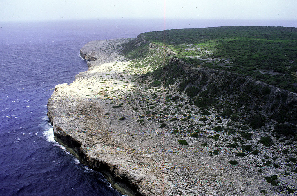
Deutsch: Luftaufnahme der Ostküste von Navassa, Blickrichtung Süden
English: Aerial photo of the east coast of Navassa Island, looking south |
| Dátum | not specified |
| Forrás | http://coastal.er.usgs.gov/navassa/geology/terraces4.html |
| Szerző | USGS |
Licenc
This image is in the public domain in the United States because it only contains materials that originally came from the United States Geological Survey, an agency of the United States Department of the Interior. For more information, see the official USGS copyright policy.
|
Eredeti feltöltési napló
Original Uploader was Jonathunder (talk) at 22 February 2006.
00:41, 22 February 2006 . . Jonathunder (Talk | contribs) . . 1800×1185 (401,763 bytes) (United States Geological Survey aerial photo of the east coast of Navassa Island, looking south. Source: http://coastal.er.usgs.gov/navassa/geology/terraces4.html)
Fájltörténet
Kattints egy időpontra, hogy a fájl akkori állapotát láthasd.
| Dátum/idő | Bélyegkép | Felbontás | Feltöltő | Megjegyzés | |
|---|---|---|---|---|---|
| aktuális | 2007. május 15., 13:41 | | 1 800 × 1 185 (392 KB) | Telim tor | {{Information |Description=Aerial photo of the east coast of Navassa Island, looking south. |Source=http://coastal.er.usgs.gov/navassa/geology/terraces4.html |Date=unknown |Author=unknown |Permission=PD, see licensing |other_versions= }} == Licensing == |
Fájlhasználat
Az alábbi lap használja ezt a fájlt:
Globális fájlhasználat
A következő wikik használják ezt a fájlt:
- Használata itt: be.wikipedia.org
- Használata itt: de.wikipedia.org
- Használata itt: el.wikipedia.org
- Használata itt: en.wikipedia.org
- Használata itt: fa.wikipedia.org
- Használata itt: fr.wikipedia.org
- Használata itt: io.wikipedia.org
- Használata itt: ka.wikipedia.org
- Használata itt: lv.wikipedia.org
- Használata itt: nds.wikipedia.org
- Használata itt: no.wikipedia.org
- Használata itt: pa.wikipedia.org
- Használata itt: pl.wikipedia.org
- Használata itt: pnb.wikipedia.org
- Használata itt: pt.wikibooks.org
- Használata itt: ru.wikipedia.org
- Használata itt: su.wikipedia.org
- Használata itt: th.wikipedia.org
- Használata itt: uz.wikipedia.org
- Használata itt: vi.wikipedia.org
- Használata itt: yo.wikipedia.org