Fájl:Scharnhorst-22.jpg

Az előnézet mérete: 704 × 599 képpont További felbontások: 282 × 240 képpont | 564 × 480 képpont | 740 × 630 képpont.
Eredeti fájl (740 × 630 képpont, fájlméret: 324 KB, MIME-típus: image/jpeg)
Fájltörténet
Kattints egy időpontra, hogy a fájl akkori állapotát láthasd.
| Dátum/idő | Bélyegkép | Felbontás | Feltöltő | Megjegyzés | |
|---|---|---|---|---|---|
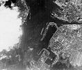
| aktuális | 2005. szeptember 17., 14:43 |  | 740 × 630 (324 KB) | Igiveup | Aerial reconnaissance photograph, probably taken by the British Royal Air Force circa February-June 1942. The arrow in the lower center marks the position of the battleship Scharnhorst, which was then under repair at the Kiel navy yard for damage received |
Fájlhasználat
Az alábbi lap használja ezt a fájlt:
Globális fájlhasználat
A következő wikik használják ezt a fájlt:
- Használata itt: ca.wikipedia.org
- Használata itt: en.wikipedia.org
- Használata itt: es.wikipedia.org
- Használata itt: it.wikipedia.org
- Használata itt: ta.wikipedia.org
- Használata itt: uk.wikipedia.org
- Használata itt: zh.wikipedia.org
