Fájl:Stanford-linear-accelerator-usgs-ortho-kaminski-5900.jpg
Az előnézet mérete: 800 × 201 képpont További felbontások: 320 × 80 képpont | 640 × 161 képpont | 1 024 × 257 képpont | 1 280 × 321 képpont | 5 900 × 1 480 képpont.
Eredeti fájl (5 900 × 1 480 képpont, fájlméret: 1,88 MB, MIME-típus: image/jpeg)
|
Ez a fájl a Wikimedia Commonsból származik. Az alább látható leírás az ottani dokumentációjának másolata. A Commons projekt szabad licencű kép- és multimédiatár. Segíts te is az építésében! |
Összefoglaló
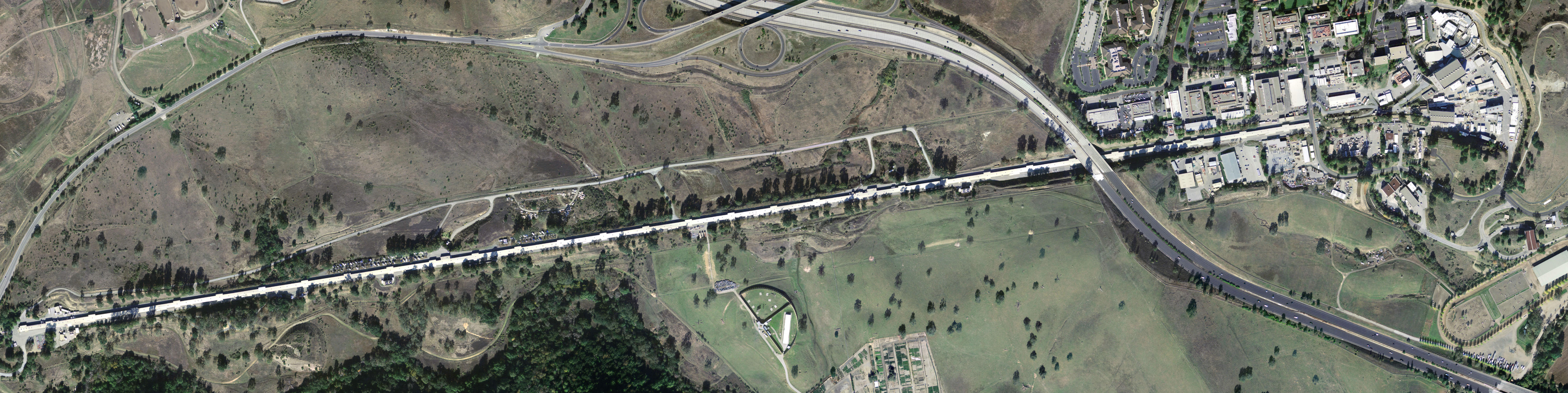
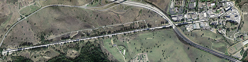
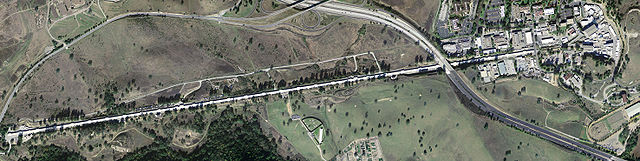
| Leírás | Stanford Linear Accelerator, shown in an aerial digital orthoimage. The two roads seen near the accelerator are California Interstate 280 (to the East) and Sand Hill Road (along the Northwest). |
| Dátum | |
| Forrás | United States Geological Survey |
| Szerző | Peter Kaminski |
Licenc
This image is in the public domain in the United States because it only contains materials that originally came from the United States Geological Survey, an agency of the United States Department of the Interior. For more information, see the official USGS copyright policy.
|
Fájltörténet
Kattints egy időpontra, hogy a fájl akkori állapotát láthasd.
| Dátum/idő | Bélyegkép | Felbontás | Feltöltő | Megjegyzés | |
|---|---|---|---|---|---|
| aktuális | 2005. május 8., 09:56 | 5 900 × 1 480 (1,88 MB) | Floriang | Stanford Linear Accelerator, shown in an aerial digital orthoimage. Image data acquired 2004-02-27 by the United States Geological Survey. This image created by Peter Kaminski, 2004-12-19 and uploaded in the public domain. {{ |
Fájlhasználat
Az alábbi lap használja ezt a fájlt:
Globális fájlhasználat
A következő wikik használják ezt a fájlt:
- Használata itt: ar.wikipedia.org
- Használata itt: ca.wikipedia.org
- Használata itt: cs.wikipedia.org
- Használata itt: de.wikipedia.org
- Használata itt: en.wikipedia.org
- SLAC National Accelerator Laboratory
- Electron scattering
- John Duncan (artist)
- List of Historic Mechanical Engineering Landmarks
- Portal talk:California
- User:Cullen328/sandbox/Stanford
- User:IndianFace/sandbox
- Portal:San Francisco Bay Area/Years/Archive
- Portal:San Francisco Bay Area/Years/53
- Timeline of the San Francisco Bay Area
- Használata itt: en.wikibooks.org
- Használata itt: es.wikipedia.org
- Használata itt: fi.wikipedia.org
- Használata itt: fr.wikipedia.org
- Használata itt: it.wikipedia.org
- Használata itt: ja.wikipedia.org
- Használata itt: ko.wikipedia.org
- Használata itt: la.wikipedia.org
- Használata itt: lt.wikipedia.org
- Használata itt: nl.wikipedia.org
- Használata itt: nn.wikipedia.org
- Használata itt: pl.wikipedia.org
- Használata itt: pt.wikipedia.org
- Használata itt: ro.wikipedia.org
- Használata itt: ru.wikipedia.org
- Használata itt: sk.wikipedia.org
- Használata itt: sv.wikipedia.org
- Használata itt: tr.wikipedia.org
- Használata itt: uk.wikipedia.org
- Használata itt: ur.wikipedia.org