Fájl:Balkan boundaries1876map1914.png

Eredeti fájl (984 × 712 képpont, fájlméret: 73 KB, MIME-típus: image/png)
|
Ez a fájl a Wikimedia Commonsból származik. Az alább látható leírás az ottani dokumentációjának másolata. A Commons projekt szabad licencű kép- és multimédiatár. Segíts te is az építésében! |

|
This map has been uploaded by Electionworld from en.wikipedia.org to enable the |
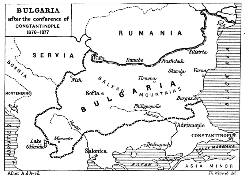
| Leírás | Map from "Report of the International Commission To Inquire into the Causes and Conduct of the Balkan Wars" 1914. |
| Dátum | Map printed and published 1914 |
| Forrás | a map |
| Szerző | Source: [1] - JPG to PNG by Iain 09:30, 13 June 2006 (UTC) |
| Engedély (Fájl újrafelhasználása) |
Original File PD |
| Más változatok | Original Image Image:Balkan boundaries1876map1914.jpg now redundant |
|
Ez a mű közkincs abban az országban, ahol elkészítették, és minden olyan további államban, ahol a szerzői jogi védelmi idő a szerző élete plusz 70 év vagy kevesebb.
| |
| Megállapították, hogy ez a fájl mentes mindenféle szerzői jogi korlátozástól, beleértve az összes kapcsolódó és hozzátartozó jogot. | |
Fájltörténet
Kattints egy időpontra, hogy a fájl akkori állapotát láthasd.
| Dátum/idő | Bélyegkép | Felbontás | Feltöltő | Megjegyzés | |
|---|---|---|---|---|---|
| aktuális | 2006. december 21., 00:17 | | 984 × 712 (73 KB) | Electionworld | {{ew|en|Iain}} {{Information| |Description = Map from "Report of the International Commission To Inquire into the Causes and Conduct of the Balkan Wars" 1914. |Date = Map printed and published 1914 |Author = Source: [http://www.lib.utexas.edu/maps/histori |
Fájlhasználat
Az alábbi lap használja ezt a fájlt:
Globális fájlhasználat
A következő wikik használják ezt a fájlt:
- Használata itt: ar.wikipedia.org
- Használata itt: bg.wikipedia.org
- Használata itt: bs.wikipedia.org
- Használata itt: ca.wikipedia.org
- Használata itt: de.wikipedia.org
- Használata itt: el.wikipedia.org
- Használata itt: en.wikipedia.org
- Használata itt: et.wikipedia.org
- Használata itt: fa.wikipedia.org
- Használata itt: fr.wikipedia.org
- Használata itt: hr.wikipedia.org
- Használata itt: it.wikipedia.org
- Használata itt: mk.wikipedia.org
- Használata itt: nl.wikipedia.org
- Használata itt: no.wikipedia.org
- Használata itt: pl.wikipedia.org
- Használata itt: pt.wikipedia.org
- Használata itt: ro.wikipedia.org
- Használata itt: simple.wikipedia.org
- Használata itt: sk.wikipedia.org
- Használata itt: sq.wikipedia.org
- Használata itt: sr.wikipedia.org
- Használata itt: tr.wikipedia.org
- Használata itt: uk.wikipedia.org
- Használata itt: www.wikidata.org