Fájl:Broad Fourteens delisle 1743.jpg
Eredeti fájl (888 × 864 képpont, fájlméret: 242 KB, MIME-típus: image/jpeg)
|
Ez a fájl a Wikimedia Commonsból származik. Az alább látható leírás az ottani dokumentációjának másolata. A Commons projekt szabad licencű kép- és multimédiatár. Segíts te is az építésében! |
| Leírás |
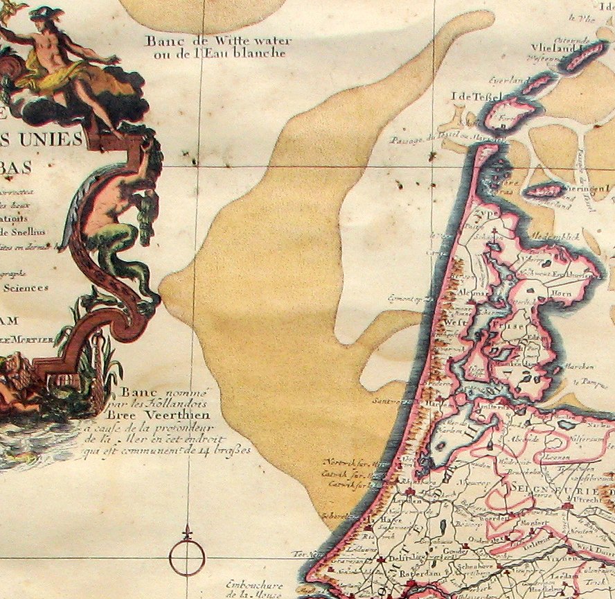
English: Map of The Netherlands (Broad Fourteens fragment), publication date circa 1743
Nederlands: Kaart van Nederland (Breeveertienfragment), publicatie ca 1743
Français : Carte des Provinces Unies des Pays Bas (Fragment "Breeveertien"), par G. de L'Isle, A Amsterdam 1743 |
| Dátum | (UTC) |
| Forrás |
|
| Szerző |
|
| Ez egy retusált kép, ami azt jelenti, hogy az eredetihez képest digitálisan módosították. Módosítások: cropped to Broad Fourteen area. Az eredeti itt található: PaysBas delisle 1743.jpg. Módosította: Hans Erren.
|
|
Ez a mű közkincs abban az országban, ahol elkészítették, és minden olyan további államban, ahol a szerzői jogi védelmi idő a szerző élete plusz 70 év vagy kevesebb.
| |
| Megállapították, hogy ez a fájl mentes mindenféle szerzői jogi korlátozástól, beleértve az összes kapcsolódó és hozzátartozó jogot. | |
Eredeti feltöltési napló
This image is a derivative work of the following images:
- File:PaysBas_delisle_1743.jpg licensed with Cc-pd-mark-footer, PD-old
- 2011-05-30T18:47:41Z Hans Erren 2592x1944 (7082127 Bytes) colour correction
- 2010-06-26T20:56:34Z Hans Erren 2592x1944 (5523080 Bytes) {{Information |Description={{en|1=Map of The Netherlands, publication date circa 1743}} {{nl|1=Kaart van Nederland, publicatie ca 1743}} {{fr|1=Carte des Provinces Unies des Pays Bas, par G. de L'Isle, A Amsterdam 1743}} |Sou
Uploaded with derivativeFX
Fájltörténet
Kattints egy időpontra, hogy a fájl akkori állapotát láthasd.
| Dátum/idő | Bélyegkép | Felbontás | Feltöltő | Megjegyzés | |
|---|---|---|---|---|---|
| aktuális | 2011. május 30., 20:55 | | 888 × 864 (242 KB) | Hans Erren | {{Information |Description={{en|1=Map of The Netherlands (Broad Fourteens fragment), publication date circa 1743}} {{nl|1=Kaart van Nederland (Breeveertienfragment), publicatie ca 1743}} {{fr|1=Carte des Provinces Unies des Pays Bas (Fragment "Breeveert |
Fájlhasználat
Az alábbi lapok használják ezt a fájlt:
Globális fájlhasználat
A következő wikik használják ezt a fájlt:
- Használata itt: ar.wikipedia.org
- Használata itt: en.wikipedia.org
- Használata itt: it.wikipedia.org
- Használata itt: nl.wikipedia.org