Fájl:IFR low altitude enroute chart Washington D.C area.tif

Ennek a(z) TIF fájlnak ezen JPG formátumú előnézete: 749 × 599 képpont. További felbontások: 300 × 240 képpont | 600 × 480 képpont | 960 × 768 képpont | 1 280 × 1 024 képpont | 2 560 × 2 048 képpont | 5 626 × 4 501 képpont.
Eredeti fájl (5 626 × 4 501 képpont, fájlméret: 10,12 MB, MIME-típus: image/tiff)
|
Ez a fájl a Wikimedia Commonsból származik. Az alább látható leírás az ottani dokumentációjának másolata. A Commons projekt szabad licencű kép- és multimédiatár. Segíts te is az építésében! |
Összefoglaló
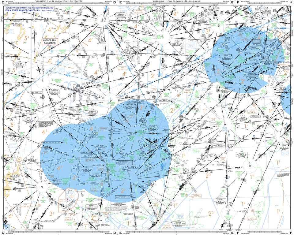
| Leírás | This low altitude section chart is issued for use in air navigation under en:Instrument Flight Rules. The dimensions of this depicted area around Washington D.C. are nearly 280 and 220 nautical miles. |
| Dátum | |
| Forrás | This is a derivative work originated from a chart package issued by the Federal Aviation Administration. The following changes were made: extracted pages D to F, title strip, "NOT FOR REAL" tag for safety. |
| Szerző | User:Orion 8 |
Licenc
This image or file is a work of a Federal Aviation Administration employee, taken or made as part of that person's official duties. As a work of the U.S. federal government, the image is in the public domain in the United States.
|
 |
Fájltörténet
Kattints egy időpontra, hogy a fájl akkori állapotát láthasd.
| Dátum/idő | Bélyegkép | Felbontás | Feltöltő | Megjegyzés | |
|---|---|---|---|---|---|
| aktuális | 2013. november 7., 23:22 |  | 5 626 × 4 501 (10,12 MB) | Orion 8 | {{Information |Description= - |Source= |Date= |Author= |Permission= |other_versions= }} |
Fájlhasználat
Az alábbi lap használja ezt a fájlt:
Globális fájlhasználat
A következő wikik használják ezt a fájlt:
- Használata itt: ar.wikipedia.org