Fájl:Map of Baluchistan from The Imperial Gazetteer of India (1907-1909).jpg
Az előnézet mérete: 710 × 599 képpont További felbontások: 284 × 240 képpont | 569 × 480 képpont | 1 000 × 844 képpont.
Eredeti fájl (1 000 × 844 képpont, fájlméret: 254 KB, MIME-típus: image/jpeg)
|
Ez a fájl a Wikimedia Commonsból származik. Az alább látható leírás az ottani dokumentációjának másolata. A Commons projekt szabad licencű kép- és multimédiatár. Segíts te is az építésében! |
Összefoglaló
| Leírás |
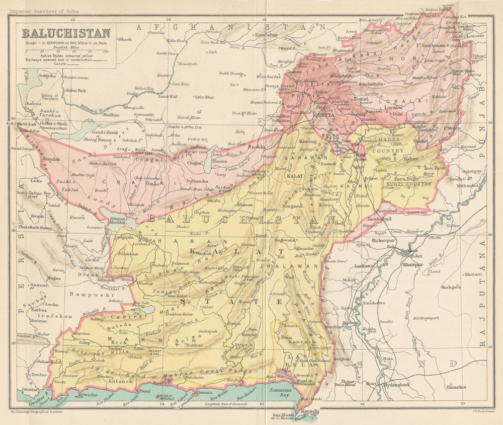
English: Map of Baluchistan from The Imperial Gazetteer of India Volume 6, opposite page 336.. New edition, published under the authority of His Majesty's Secretary of State for India in Council. Oxford: Clarendon Press, 1907-1909.
Scale: 1:6,000,000. 1 in. to 94.6 miles. Native States colored yellow. |
| Dátum | és 1909 között |
| Forrás | http://dsal.uchicago.edu/maps/gazetteer/index.html |
| Szerző | John G. Bartholomew |
| Más változatok |

.jpg)
Licenc
A szerző halálozási ideje 1920, ezért ez a mű közkincs abban az országban, ahol elkészítették, és minden olyan további államban, ahol a szerzői jogi védelmi idő a szerző élete plusz 100 év vagy kevesebb. | |
| Megállapították, hogy ez a fájl mentes mindenféle szerzői jogi korlátozástól, beleértve az összes kapcsolódó és hozzátartozó jogot. | |
Fájltörténet
Kattints egy időpontra, hogy a fájl akkori állapotát láthasd.
| Dátum/idő | Bélyegkép | Felbontás | Feltöltő | Megjegyzés | |
|---|---|---|---|---|---|
| aktuális | 2014. október 8., 08:19 | | 1 000 × 844 (254 KB) | Co9man | User created page with UploadWizard |
Fájlhasználat
Az alábbi lapok használják ezt a fájlt:
Globális fájlhasználat
A következő wikik használják ezt a fájlt:
- Használata itt: bn.wikipedia.org
- Használata itt: ca.wikipedia.org
- Használata itt: de.wikipedia.org
- Használata itt: en.wikipedia.org
- Használata itt: es.wikipedia.org
- Használata itt: fa.wikipedia.org
- Használata itt: hi.wikipedia.org
- Használata itt: it.wikipedia.org
- Használata itt: mr.wikipedia.org
- Használata itt: pl.wikipedia.org
- Használata itt: ru.wikipedia.org
- Használata itt: ur.wikipedia.org
.jpg)