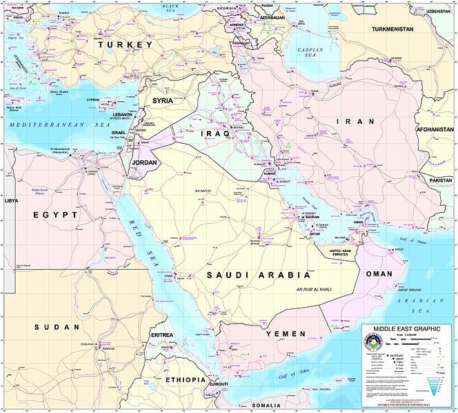
Fájl:Middle east graphic 2003.jpg

Az előnézet mérete: 664 × 600 képpont További felbontások: 266 × 240 képpont | 532 × 480 képpont | 850 × 768 képpont | 1 134 × 1 024 képpont | 2 268 × 2 048 képpont | 2 973 × 2 685 képpont.
Eredeti fájl (2 973 × 2 685 képpont, fájlméret: 3,91 MB, MIME-típus: image/jpeg)
Fájltörténet
Kattints egy időpontra, hogy a fájl akkori állapotát láthasd.
| Dátum/idő | Bélyegkép | Felbontás | Feltöltő | Megjegyzés | |
|---|---|---|---|---|---|
| aktuális | 2012. február 9., 00:30 |  | 2 973 × 2 685 (3,91 MB) | M0tty | Remove compression artefacts by a bilateral filtering. |
| 2006. július 14., 23:43 |  | 2 973 × 2 685 (1 013 KB) | Unquietwiki | ''Courtesy of the University of Texas Libraries, The University of Texas at Austin'' [http://www.lib.utexas.edu/maps/middle_east.html http://www.lib.utexas.edu/maps/middle_east.html] High-resolution political / railway / roadmap of the Middle East. |
Fájlhasználat
Az alábbi lap használja ezt a fájlt:
Globális fájlhasználat
A következő wikik használják ezt a fájlt:
- Használata itt: ar.wikipedia.org
- ويكيبيديا:قوالب/بذور
- ويكيبيديا:قوالب/بذور/جدول بذرة 1
- قالب:بذرة جغرافيا الشرق الأوسط
- بادية الشام
- محافظة العاصمة (البحرين)
- خليج عدن
- دزفول
- زاغروس
- مسجد سليمان
- زاينده
- مسرح أحداث الشرق الأوسط خلال الحرب العالمية الثانية
- الحويزة (مدينة)
- قائمة جزر الخليج العربي
- شرق المتوسط
- قائمة نزاعات الشرق الأوسط الحديثة
- مستخدم:Adnanzoom/مساعدات
- عبد الله بن سعيد
- قرار مجلس الأمن التابع للأمم المتحدة رقم 1381
- مستخدم:ASammour/بذرة-بوابة
- شرف الدين بن الحسن
- فخر الدين بن عدي
- صخر بن صخر بن مسافر
- قالب:بذرة أعلام الشرق الأوسط
- أبجر التاسع
- Használata itt: arz.wikipedia.org
- Használata itt: ba.wikipedia.org
- Használata itt: be.wikipedia.org
- Használata itt: bn.wikipedia.org
- Használata itt: ca.wikipedia.org
- Használata itt: ce.wikipedia.org
- Használata itt: ckb.wikipedia.org
- Használata itt: el.wikipedia.org
- Használata itt: en.wikipedia.org
A fájl globális használatának megtekintése


