Fájl:NPS american-samoa-regional-map.pdf

Nem érhető el nagyobb felbontású változat.
NPS_american-samoa-regional-map.pdf (770 × 429 képpont, fájlméret: 53 KB, MIME-típus: application/pdf)
|
Ez a fájl a Wikimedia Commonsból származik. Az alább látható leírás az ottani dokumentációjának másolata. A Commons projekt szabad licencű kép- és multimédiatár. Segíts te is az építésében! |
Összefoglaló
| Leírás |
English: Regional map, showing the islands of American Samoa in relation to Western Samoa and other points of interest. |
| Dátum | |
| Forrás | U.S. National Park Service (http://npmaps.com/wp-content/uploads/american-samoa-regional-map.pdf) |
| Szerző | U.S. National Park Service, restoration/cleanup by Matt Holly |
| Más változatok |
 |
Licenc
| This image or media file contains material based on a work of a National Park Service employee, created as part of that person's official duties. As a work of the U.S. federal government, such work is in the public domain in the United States. See the NPS website and NPS copyright policy for more information. |
Fájltörténet
Kattints egy időpontra, hogy a fájl akkori állapotát láthasd.
| Dátum/idő | Bélyegkép | Felbontás | Feltöltő | Megjegyzés | |
|---|---|---|---|---|---|
| aktuális | 2017. május 13., 20:35 | 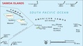 | 770 × 429 (53 KB) | RKBot | =={{int:filedesc}}== {{Information |description= {{en|1=Regional map, showing the islands of American Samoa in relation to Western Samoa and other points of interest.}} |date= 2016-02-22 |source= U.S. National Park Service (http://npmaps.com/wp-content... |
Fájlhasználat
Az alábbi lap használja ezt a fájlt:
Globális fájlhasználat
A következő wikik használják ezt a fájlt:
- Használata itt: de.wikipedia.org
- Használata itt: fr.wikipedia.org