Fájl:Pinus ponderosa subspecies range map.png
Az előnézet mérete: 489 × 599 képpont További felbontások: 196 × 240 képpont | 609 × 746 képpont.
Eredeti fájl (609 × 746 képpont, fájlméret: 77 KB, MIME-típus: image/png)
|
Ez a fájl a Wikimedia Commonsból származik. Az alább látható leírás az ottani dokumentációjának másolata. A Commons projekt szabad licencű kép- és multimédiatár. Segíts te is az építésében! |
| Leírás |
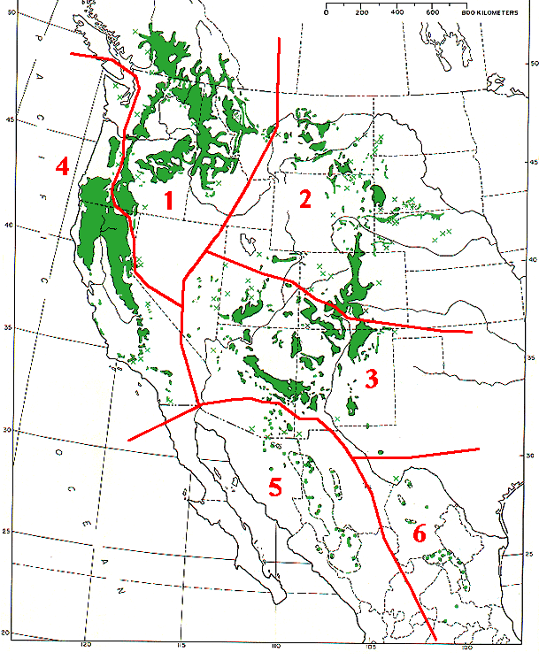
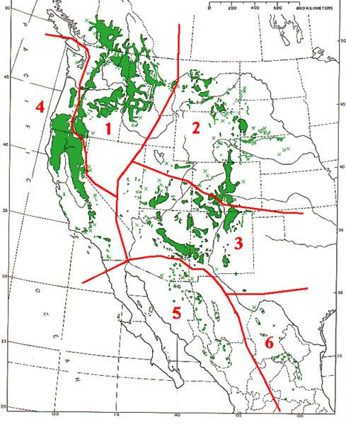
Range map of Pinus ponderosa and Pinus arizonica
|
|||
| Dátum | ||||
| Forrás | Base map (black outlines & green range map) is from USDA Forest Service Misc,.Publ. 991 (public domain-USGov); red delineation is my work, which I release into public domain | |||
| Szerző | MPF | |||
| Engedély (Fájl újrafelhasználása) |
|
Fájltörténet
Kattints egy időpontra, hogy a fájl akkori állapotát láthasd.
| Dátum/idő | Bélyegkép | Felbontás | Feltöltő | Megjegyzés | |
|---|---|---|---|---|---|
| aktuális | 2009. december 7., 16:09 | | 609 × 746 (77 KB) | MPF | {{Information |Description=Range map of ''Pinus ponderosa'' and ''Pinus arizonica'' # ''Pinus ponderosa'' subsp. ''ponderosa'' - North Plateau Ponderosa Pine # ''Pinus ponderosa'' subsp. ''scopulorum'' - Rocky Mts Ponderosa Pine # ''Pinus ponderos |
Fájlhasználat
Ezt a fájlt nem használja egyetlen lap sem.
Globális fájlhasználat
A következő wikik használják ezt a fájlt:
- Használata itt: arz.wikipedia.org
- Használata itt: ca.wikipedia.org
- Használata itt: cs.wikipedia.org
- Használata itt: el.wikipedia.org
- Használata itt: es.wikipedia.org
- Használata itt: id.wikipedia.org
- Használata itt: nl.wikipedia.org
- Használata itt: pl.wikipedia.org
- Használata itt: pt.wikipedia.org
- Használata itt: sv.wikipedia.org
- Használata itt: tr.wikipedia.org
- Használata itt: uk.wikipedia.org
- Használata itt: www.wikidata.org