Fájl:Plan de Paris 1705 BNF07710700.png
Az előnézet mérete: 739 × 600 képpont További felbontások: 296 × 240 képpont | 591 × 480 képpont | 946 × 768 képpont | 1 261 × 1 024 képpont | 2 523 × 2 048 képpont | 3 890 × 3 158 képpont.
Eredeti fájl (3 890 × 3 158 képpont, fájlméret: 15,89 MB, MIME-típus: image/png)
|
Ez a fájl a Wikimedia Commonsból származik. Az alább látható leírás az ottani dokumentációjának másolata. A Commons projekt szabad licencű kép- és multimédiatár. Segíts te is az építésében! |
Összefoglaló
| Szerző |
|
||||||||||||||||||||
| Leírás |
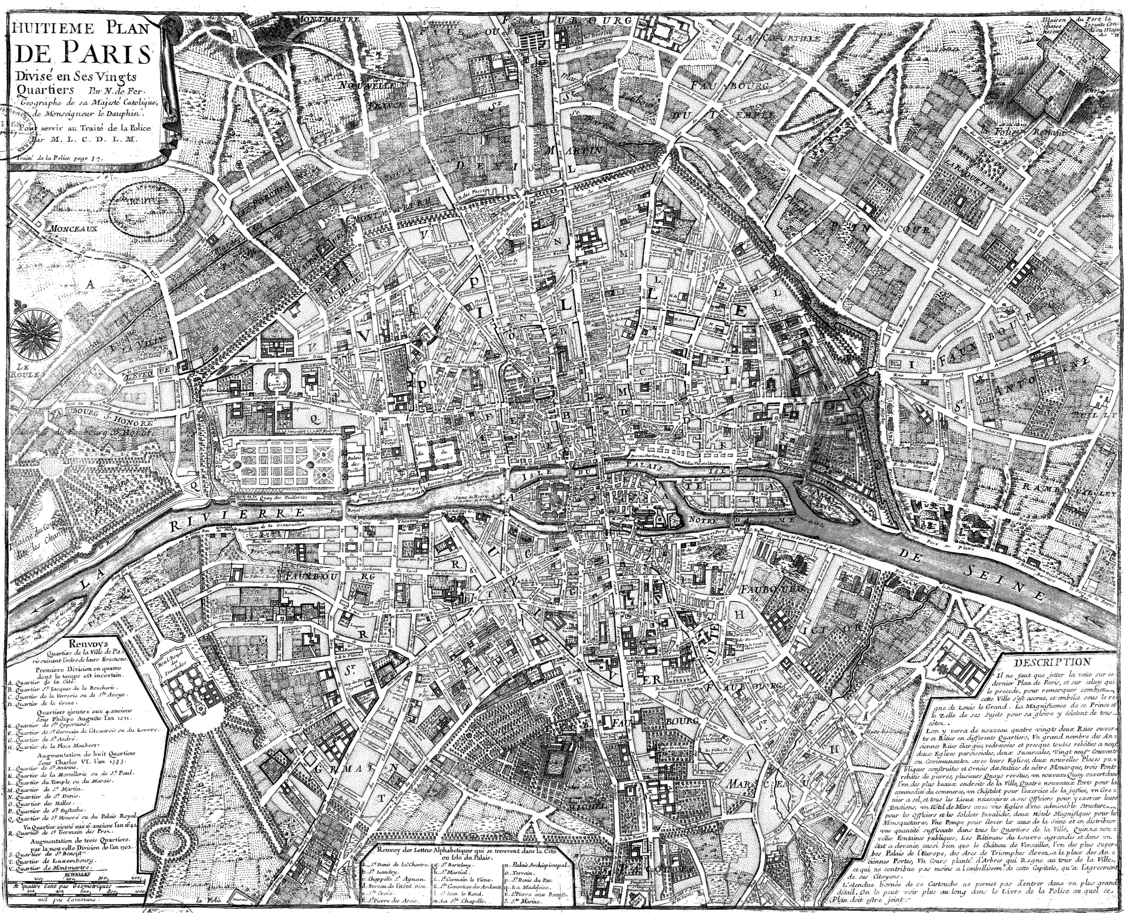
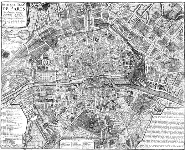
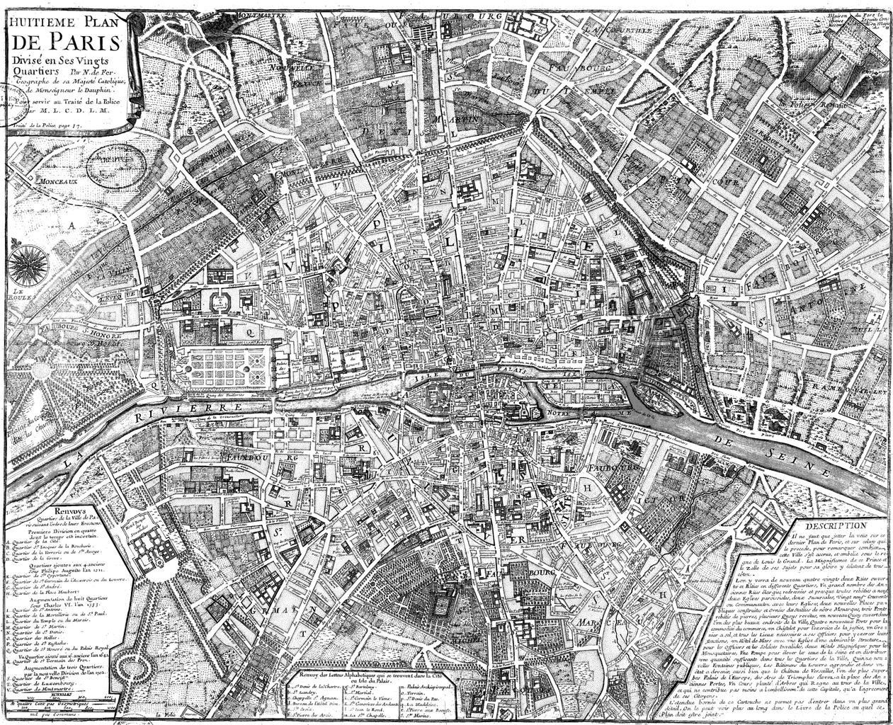
Français : Huitième plan de Paris divisé en ses vingts quartiers [Image fixe numérisée] / par N. de Fer Publication : Paris, 1705 Description matérielle : 1 carte ; 44,5 x 54,5 cm Collection : Collection d'Anville ; 00808 Note(s) : Cote : Ge DD 2987 (808) BNF Richelieu Cartes et Plans Reprod. 85 C 125661 ; Reprod. Sc 87/660 . - Légende et description en marge gauche et droite. Carte "pour servir au traité de la Police par M.L.C.D.L.M. Traité de la Police p. 87" Sujet(s) : Paris (France) -- Quartiers anciens Notice n° : FRBNF38638263 |
||||||||||||||||||||
| Dátum | 1705 | ||||||||||||||||||||
| Forrás/fényképész | Gallica | ||||||||||||||||||||
| Más változatok |
|
||||||||||||||||||||


| Open this image as an overlay in Google Earth (Google Maps, Bing) | (Help|Source) |
Licenc
|
Ez a mű közkincs abban az országban, ahol elkészítették, és minden olyan további államban, ahol a szerzői jogi védelmi idő a szerző élete plusz 100 év vagy kevesebb. | |
| Megállapították, hogy ez a fájl mentes mindenféle szerzői jogi korlátozástól, beleértve az összes kapcsolódó és hozzátartozó jogot. | |
| Previous public domain rationale, no longer applicable | ||
|---|---|---|
|
Fájltörténet
Kattints egy időpontra, hogy a fájl akkori állapotát láthasd.
| Dátum/idő | Bélyegkép | Felbontás | Feltöltő | Megjegyzés | |
|---|---|---|---|---|---|
| aktuális | 2008. június 9., 11:20 | | 3 890 × 3 158 (15,89 MB) | Yann | reduce to below 12.5 Mpx, otherwise it will never display with Wikimedia limits. Nothing is lost (see history for the complete version, or the reference link) |
| 2005. szeptember 22., 22:47 |  | 4 183 × 3 396 (2,76 MB) | David.Monniaux | Map of Paris in 1705 Type : image fixe, monographie Titre(s) : Huitième plan de Paris divisé en ses vingts quartiers [Image fixe numérisée] / par N. de Fer Publication : Paris, 1705 Description matérielle : 1 carte ; 44,5 x 54,5 cm Colle |
Fájlhasználat
Az alábbi lap használja ezt a fájlt:
Globális fájlhasználat
A következő wikik használják ezt a fájlt:
- Használata itt: ar.wikipedia.org
- Használata itt: en.wikipedia.org
- Használata itt: fr.wikipedia.org
- Használata itt: gl.wikipedia.org
- Használata itt: he.wikipedia.org
- Használata itt: it.wikipedia.org
- Használata itt: ja.wikipedia.org
- Használata itt: ko.wikipedia.org
- Használata itt: nl.wikipedia.org
- Használata itt: pl.wikipedia.org
- Használata itt: pnb.wikipedia.org
- Használata itt: ur.wikipedia.org