Fájl:Spezialkarte 4956 Neunkirchen und Aspang.jpg

Eredeti fájl (7 259 × 5 642 képpont, fájlméret: 43,79 MB, MIME-típus: image/jpeg)
|
Ez a fájl a Wikimedia Commonsból származik. Az alább látható leírás az ottani dokumentációjának másolata. A Commons projekt szabad licencű kép- és multimédiatár. Segíts te is az építésében! |
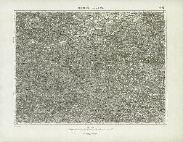
| Leírás | historische Landkarte: Spezialkarte 1:75.000, franzisco-josephinische (3.) Landesaufnahme der österreichisch-ungarischen Monarchie. Blatt Neunkirchen und Aspang 4956 (südliches Wiener Becken mit Buckliger Welt bis Kirchschlag, Mönichkirchen, Wechsel, Feistritzsattel). |
| Dátum | nach Zeichenschlüssel 1894, linke untere Ecke "19.II.17" (blass auch noch 28. III.16), rechts unten: "teilweise berichtigt bis 15. Februar 1915" |
| Forrás | k.u.k. militär-geographisches Institut. |
| Szerző | Geripp Assistent Jrblich, Terrain Leut. Schüller, k.u.k. militär-geographisches Institut, |
| Engedély (Fájl újrafelhasználása) |
historisches amtliches Werk aus dem 19. Jahrhundert, freies Werk |
|
Ez a mű közkincs abban az országban, ahol elkészítették, és minden olyan további államban, ahol a szerzői jogi védelmi idő a szerző élete plusz 70 év vagy kevesebb.
| |
| Megállapították, hogy ez a fájl mentes mindenféle szerzői jogi korlátozástól, beleértve az összes kapcsolódó és hozzátartozó jogot. | |
Fájltörténet
Kattints egy időpontra, hogy a fájl akkori állapotát láthasd.
| Dátum/idő | Bélyegkép | Felbontás | Feltöltő | Megjegyzés | |
|---|---|---|---|---|---|
| aktuális | 2010. június 22., 21:24 | | 7 259 × 5 642 (43,79 MB) | Josef Moser | {{Information |Description=historische Landkarte: Spezialkarte 1:75.000, franzisco-josephinische (3.) Landesaufnahme der österreichisch-ungarischen Monarchie. Blatt Neunkirchen und Aspang 4956 (südliches Wiener Becken mit Buckliger Welt bis Kirchschlag, |
Fájlhasználat
Az alábbi lap használja ezt a fájlt:
Globális fájlhasználat
A következő wikik használják ezt a fájlt:
- Használata itt: de.wikipedia.org