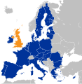
Fájl:Location map of the United Kingdom and the European Union.svg

Ennek a(z) SVG fájlnak ezen PNG formátumú előnézete: 587 × 600 képpont. További felbontások: 235 × 240 képpont | 470 × 480 képpont | 752 × 768 képpont | 1 002 × 1 024 képpont | 2 004 × 2 048 képpont | 593 × 606 képpont.
Eredeti fájl (SVG fájl, névlegesen 593 × 606 képpont, fájlméret: 708 KB)
Fájltörténet
Kattints egy időpontra, hogy a fájl akkori állapotát láthasd.
| Dátum/idő | Bélyegkép | Felbontás | Feltöltő | Megjegyzés | |
|---|---|---|---|---|---|
| aktuális | 2022. december 27., 12:10 |  | 593 × 606 (708 KB) | Iktsokh | Correction of borders |
| 2019. március 27., 05:03 |  | 593 × 606 (702 KB) | Nice4What | Reverted to version as of 08:03, 28 August 2016 (UTC) Northern Cyprus is shown as part as Cyprus in all other EU maps | |
| 2017. február 2., 18:55 |  | 593 × 606 (704 KB) | RaviC | Shaded regions with partial EU treaty application (Customs Union) per https://www.gov.uk/government/uploads/system/uploads/attachment_data/file/588948/The_United_Kingdoms_exit_from_and_partnership_with_the_EU_Web.pdf | |
| 2016. augusztus 29., 07:52 |  | 593 × 606 (704 KB) | Turnless | Reverted to version as of 12:49, 25 June 2016 (UTC) COM:OVERWRITE violation, you can create a new map if you'd like. | |
| 2016. augusztus 28., 10:03 |  | 593 × 606 (702 KB) | Bazonka | Northern Cyprus is de jure part of the EU | |
| 2016. június 25., 14:49 |  | 593 × 606 (704 KB) | Steinsplitter | Reverted to version as of 17:57, 18 June 2016 (UTC): COM:OVERWRITE violation | |
| 2016. június 25., 14:08 |  | 792 × 792 (2,87 MB) | ThiefOfBagdad | Full EU view | |
| 2016. június 18., 19:57 |  | 593 × 606 (704 KB) | RaviC | + Gib | |
| 2016. június 16., 07:37 |  | 593 × 606 (703 KB) | Turnless | Update layout | |
| 2016. május 27., 12:30 |  | 632 × 637 (765 KB) | Furfur | new color, better visibility |
Fájlhasználat
Az alábbi lapok használják ezt a fájlt:
Globális fájlhasználat
A következő wikik használják ezt a fájlt:
- Használata itt: af.wikipedia.org
- Használata itt: ar.wikipedia.org
- Használata itt: ast.wikipedia.org
- Használata itt: az.wikipedia.org
- Használata itt: ba.wikipedia.org
- Használata itt: be.wikipedia.org
- Használata itt: bg.wikipedia.org
- Használata itt: bh.wikipedia.org
- Használata itt: bn.wikipedia.org
- Használata itt: br.wikipedia.org
- Használata itt: bs.wikipedia.org
- Használata itt: cs.wikipedia.org
- Használata itt: cy.wikipedia.org
- Használata itt: da.wikipedia.org
- Használata itt: de.wikipedia.org
- 2016
- Benutzer:Kallewirsch
- EU-Austritt des Vereinigten Königreichs
- Benutzer:Tmid
- Benutzer:Anton-kurt/Schaufenster 2016
- Wikipedia:Hauptseite/Archiv/24. Juni 2016
- Wikipedia:Hauptseite/Archiv/3. November 2016
- März 2017
- Wikipedia:Hauptseite/Archiv/29. März 2017
- Wikipedia:Kartenwerkstatt/Archiv/2017-04
- Wikipedia:Hauptseite/Archiv/20. Juni 2017
- Wikipedia:Hauptseite/Archiv/15. November 2018
- Wikipedia:Hauptseite/Archiv/25. November 2018
- Wikipedia:Hauptseite/Archiv/26. November 2018
- EU-Mitgliedschaft des Vereinigten Königreichs
- Wikipedia:Kurier/Ausgabe 2 2020
- Handels- und Kooperationsabkommen zwischen der Europäischen Union und dem Vereinigten Königreich
- Benutzer:Gabas/Meistaufgerufene Artikel
- Használata itt: din.wikipedia.org
- Használata itt: diq.wikipedia.org
- Használata itt: en.wikipedia.org
- User:ArcMachaon/sandbox
- Brexit
- Wikipedia:In the news/Candidates/June 2016
- Template talk:United Kingdom in the European Union
- Wikipedia:Top 25 Report/June 19 to 25, 2016
- Wikipedia:Wikipedia Signpost/2016-07-04/Traffic report
- Wikipedia:Wikipedia Signpost/Single/2016-07-04
- Wikipedia:Top 25 Report/June 26 to July 2, 2016
- Talk:Brexit/Archive 1
A fájl globális használatának megtekintése