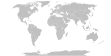
Fájl:BlankMap-World-Compact.svg

Ennek a(z) SVG fájlnak ezen PNG formátumú előnézete: 800 × 354 képpont. További felbontások: 320 × 142 képpont | 640 × 284 képpont | 1 024 × 454 képpont | 1 280 × 567 képpont | 2 560 × 1 134 képpont.
Eredeti fájl (SVG fájl, névlegesen 2 560 × 1 134 képpont, fájlméret: 1,01 MB)
Fájltörténet
Kattints egy időpontra, hogy a fájl akkori állapotát láthasd.
| Dátum/idő | Bélyegkép | Felbontás | Feltöltő | Megjegyzés | |
|---|---|---|---|---|---|
| aktuális | 2023. október 11., 14:56 |  | 2 560 × 1 134 (1,01 MB) | Yodin | Latest version is minified, and no longer easily text-editable; Reverted to version as of 14:50, 16 March 2019 (UTC) |
| 2023. október 10., 19:07 |  | 512 × 227 (754 KB) | Ahmed0arafat | fix african countries count to 54 | |
| 2019. március 16., 16:50 |  | 2 560 × 1 134 (1,01 MB) | Gomoloko | I corrected Transnistria tag showing in a larger area than it should, instead of Moldova | |
| 2019. március 11., 09:09 |  | 2 560 × 1 134 (1,01 MB) | Gomoloko | I corrected West Bank (State of Palestine) name not showing when the mouse was over the area | |
| 2019. március 11., 02:51 |  | 2 560 × 1 134 (1,01 MB) | Gomoloko | last change :) Gambia, Republic of The | |
| 2019. március 11., 02:25 |  | 2 560 × 1 134 (1,01 MB) | Gomoloko | I reverted all changes and made only the following according to www.un.org : North Macedonia, United States of America, Eswatini, United Kingdom of Great Britain and Northern Ireland, Cabo Verde | |
| 2019. március 10., 23:02 |  | 2 560 × 1 134 (1,01 MB) | Gomoloko | North Macedonia, Republic of _ Congo, Democratic Republic of the _ Kyrgyz Republic _ Vietnam, Socialist Republic of _ China, People's Republic of _ United States of America _ Eswatini, Kingdom of _ Cabo Verde, Republic of | |
| 2018. február 10., 23:55 |  | 2 560 × 1 134 (1,01 MB) | Fibonacci | Updated the map with land and water outlines from the original. | |
| 2012. augusztus 25., 21:32 |  | 940 × 415 (1,45 MB) | Kpengboy | Reverted to version as of 16:35, 13 February 2012 (there's a reason the code wasn't "optimised". re-add transparency if you think it's better) | |
| 2012. április 17., 22:57 |  | 940 × 415 (818 KB) | Fred the Oyster | Corrected my faux pas with the upper and lower margins |
Fájlhasználat
Ezt a fájlt nem használja egyetlen lap sem.
Globális fájlhasználat
A következő wikik használják ezt a fájlt:
- Használata itt: de.wikipedia.org
- Használata itt: en.wikipedia.org
- Használata itt: fr.wikipedia.org
- Használata itt: zh.wikipedia.org


