Fájl:C78198s1 Ant.Map Mount Harmsworth.jpg
Az előnézet mérete: 710 × 600 képpont További felbontások: 284 × 240 képpont | 568 × 480 képpont | 909 × 768 képpont | 1 212 × 1 024 képpont | 2 424 × 2 048 képpont | 3 849 × 3 252 képpont.
Eredeti fájl (3 849 × 3 252 képpont, fájlméret: 1,69 MB, MIME-típus: image/jpeg)
|
Ez a fájl a Wikimedia Commonsból származik. Az alább látható leírás az ottani dokumentációjának másolata. A Commons projekt szabad licencű kép- és multimédiatár. Segíts te is az építésében! |
Összefoglaló
| Leírás |
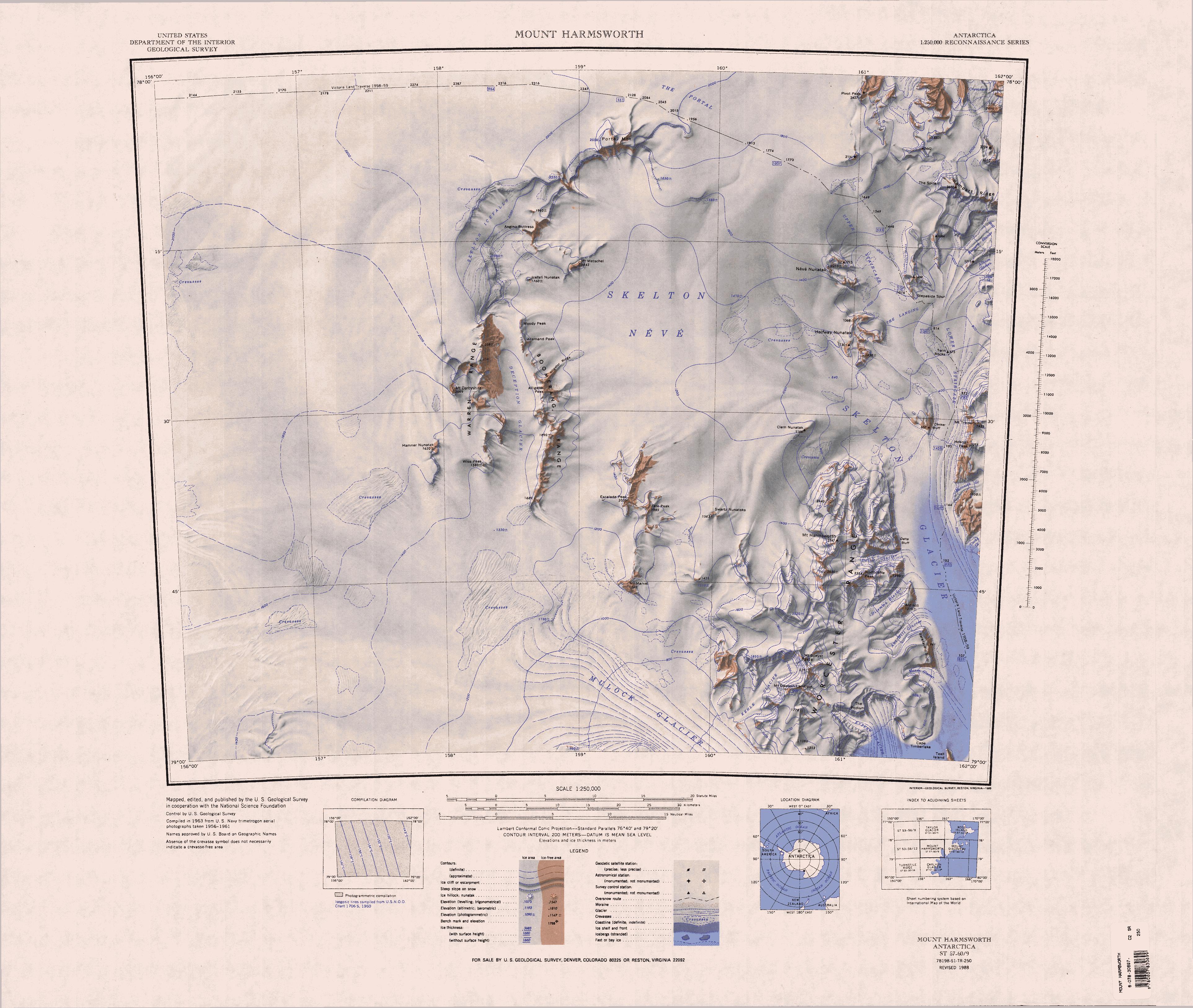
English: 1:250,000-scale topographic reconnaissance map of the Mount Harmsworth area from 156°-162'E to 78°-79°S in Antarctica. Mapped, edited and published by the U.S. Geological Survey in cooperation with the National Science Foundation. |
|||
| Dátum | ||||
| Forrás | http://usarc.usgs.gov/drg_dload.shtml | |||
| Szerző | United States Geological Survey | |||
| Engedély (Fájl újrafelhasználása) |
|
Fájltörténet
Kattints egy időpontra, hogy a fájl akkori állapotát láthasd.
| Dátum/idő | Bélyegkép | Felbontás | Feltöltő | Megjegyzés | |
|---|---|---|---|---|---|
| aktuális | 2013. április 17., 15:34 | | 3 849 × 3 252 (1,69 MB) | 4ing | == {{int:filedesc}} == {{Information |description={{en|1=1:250,000-scale topographic reconnaissance map of the Mount Harmsworth area from 156°-162'E to 78°-79°S in Antarctica. Mapped, edited and published by the U.S. Geological Survey in cooperation... |
Fájlhasználat
Az alábbi lap használja ezt a fájlt:
Globális fájlhasználat
A következő wikik használják ezt a fájlt:
- Használata itt: bg.wikipedia.org
- Használata itt: de.wikipedia.org
- Skelton-Gletscher
- Mulock-Gletscher
- The Portal
- Portal Mountain
- Skelton-Firnfeld
- Allemand Peak
- Moody Peak
- Boomerang Range
- Alligator Peak
- Alligator Ridge
- Skelton-Eisfälle
- Warren Range
- Ant Hill
- Ant-Hill-Gletscher
- Dilemma-Gletscher
- Worcester Range
- Bareface Bluff
- Mount Harmsworth
- Mason-Gletscher
- Delta-Gletscher
- Delta Bluff
- Northcliffe Peak
- Wilkniss Mountains
- Pivot Peak
- Halfway-Nunatak
- Rampart Ridge
- Deception-Gletscher
- Mount Dawson-Lambton
- Mount Speyer
- Kehle-Gletscher
- Escalade Peak
- Hamner-Nunatak
- Wise Peak
- Icefall Nunatak (Süden)
- Mount Marvel
- Mount Metschel
- Swartz-Nunatakker
- Tate Peak
- Van Allen Range
- Ross-Orogen
- Használata itt: en.wikipedia.org
A fájl globális használatának megtekintése