Fájl:Conneaut Ohio aerial view.jpg

Az előnézet mérete: 800 × 561 képpont További felbontások: 320 × 224 képpont | 640 × 449 képpont | 1 024 × 718 képpont | 1 280 × 898 képpont | 1 500 × 1 052 képpont.
Eredeti fájl (1 500 × 1 052 képpont, fájlméret: 697 KB, MIME-típus: image/jpeg)
|
Ez a fájl a Wikimedia Commonsból származik. Az alább látható leírás az ottani dokumentációjának másolata. A Commons projekt szabad licencű kép- és multimédiatár. Segíts te is az építésében! |
Összefoglaló
| Leírás |
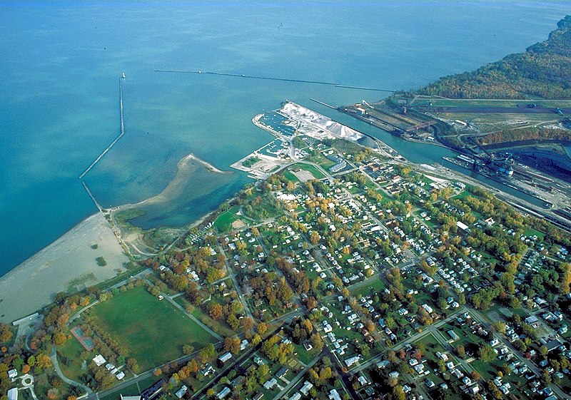
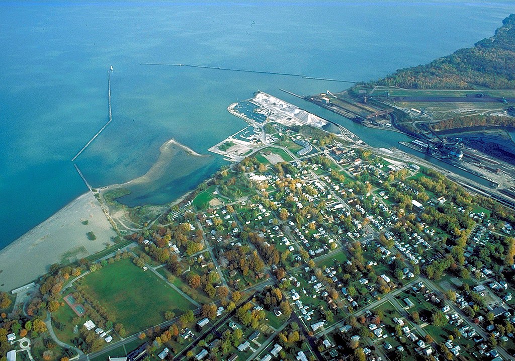
English: Aerial view of the port and harbor at Conneaut, Ohio, USA, on Lake Erie. View is to the northeast over the lake. |
| Dátum | Készült: 1992. október 28. |
| Forrás |
U.S. Army Corps of Engineers Digital Visual Library Image page Image description page Digital Visual Library home page |
| Szerző | Ken Winters, U.S. Army Corps of Engineers |
| Helyszín | Conneaut, Ohio, USA |
| Fényképező elhelyezkedése | | További képek erről a helyről: OpenStreetMap |
|---|
Licenc
This image or file is a work of a U.S. Army Corps of Engineers soldier or employee, taken or made as part of that person's official duties. As a work of the U.S. federal government, the image is in the public domain.
|
Fájltörténet
Kattints egy időpontra, hogy a fájl akkori állapotát láthasd.
| Dátum/idő | Bélyegkép | Felbontás | Feltöltő | Megjegyzés | |
|---|---|---|---|---|---|
| aktuális | 2007. március 31., 07:54 | | 1 500 × 1 052 (697 KB) | DanMS | {{Information | Description = {{en|Aerial view of the port and harbor at Conneaut, Ohio, USA, on Lake Erie. View is to the northeast over the lake.}} | Source = U.S. Army Corps of Engineers Digital Visual Library<br />[http://images.usace.army. |
Fájlhasználat
Az alábbi lap használja ezt a fájlt:
Globális fájlhasználat
A következő wikik használják ezt a fájlt:
- Használata itt: ar.wikipedia.org
- Használata itt: arz.wikipedia.org
- Használata itt: azb.wikipedia.org
- Használata itt: ca.wikipedia.org
- Használata itt: ceb.wikipedia.org
- Használata itt: ce.wikipedia.org
- Használata itt: cy.wikipedia.org
- Használata itt: dag.wikipedia.org
- Használata itt: de.wikipedia.org
- Használata itt: en.wikipedia.org
- Használata itt: en.wikivoyage.org
- Használata itt: es.wikipedia.org
- Használata itt: eu.wikipedia.org
- Használata itt: fa.wikipedia.org
- Használata itt: fr.wikipedia.org
- Használata itt: ht.wikipedia.org
- Használata itt: it.wikipedia.org
- Használata itt: ky.wikipedia.org
- Használata itt: lld.wikipedia.org
- Használata itt: pl.wikipedia.org
- Használata itt: pt.wikipedia.org
- Használata itt: sh.wikipedia.org
- Használata itt: simple.wikipedia.org
- Használata itt: sr.wikipedia.org
- Használata itt: szl.wikipedia.org
- Használata itt: tr.wikipedia.org
- Használata itt: tt.wikipedia.org
- Használata itt: uk.wikipedia.org
- Használata itt: uz.wikipedia.org
- Használata itt: vi.wikipedia.org
- Használata itt: vo.wikipedia.org
- Használata itt: www.wikidata.org
- Használata itt: zh-min-nan.wikipedia.org