Fájl:Manistique Michigan aerial view.jpg

Az előnézet mérete: 800 × 562 képpont További felbontások: 320 × 225 képpont | 640 × 449 képpont | 1 024 × 719 képpont | 1 280 × 899 képpont | 1 500 × 1 053 képpont.
Eredeti fájl (1 500 × 1 053 képpont, fájlméret: 601 KB, MIME-típus: image/jpeg)
|
Ez a fájl a Wikimedia Commonsból származik. Az alább látható leírás az ottani dokumentációjának másolata. A Commons projekt szabad licencű kép- és multimédiatár. Segíts te is az építésében! |
| Leírás |
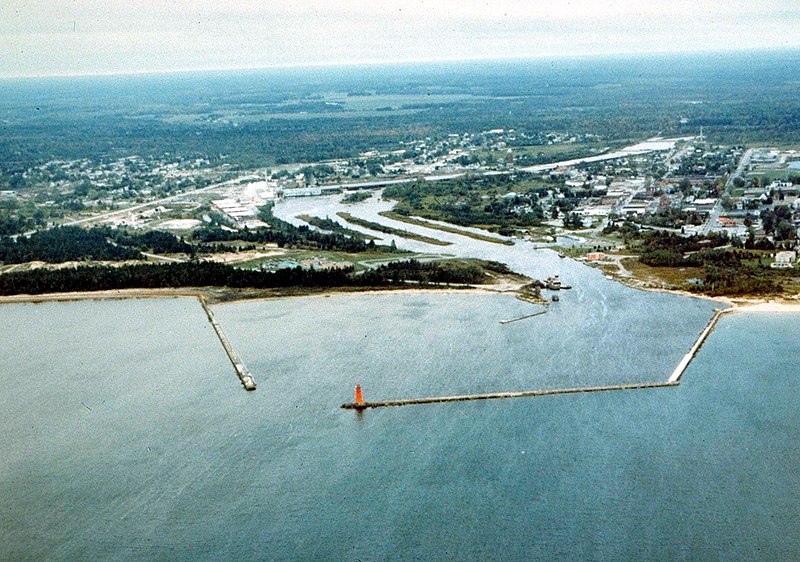
English: Aerial view of Manistique, Michigan, USA. The city lies on the northern shore of Lake Michigan in the Upper Peninsula of Michigan. The Manistique River flows through the town and into Lake Michigan through the harbor. |
|||
| Dátum | not specified or unknown | |||
| Forrás |
U.S. Army Corps of Engineers Digital Visual Library Image page Image description page Digital Visual Library home page |
|||
| Szerző | U.S. Army Corps of Engineers, photographer not specified or unknown | |||
| Engedély (Fájl újrafelhasználása) |
|
|||
| Helyszín | Manistique, Schoolcraft County, Michigan, USA |
| Fényképező elhelyezkedése | | További képek erről a helyről: OpenStreetMap |
|---|
Fájltörténet
Kattints egy időpontra, hogy a fájl akkori állapotát láthasd.
| Dátum/idő | Bélyegkép | Felbontás | Feltöltő | Megjegyzés | |
|---|---|---|---|---|---|
| aktuális | 2007. március 30., 03:30 | | 1 500 × 1 053 (601 KB) | DanMS | {{Information | Description = {{en|Aerial view of Manistique, Michigan, USA. The city lies on the northern shore of Lake Michigan in the Upper Peninsula of Michigan. The Manistique River flows through the town and into Lake Michigan through the harbor. |
Fájlhasználat
Az alábbi lap használja ezt a fájlt:
Globális fájlhasználat
A következő wikik használják ezt a fájlt:
- Használata itt: ar.wikipedia.org
- Használata itt: arz.wikipedia.org
- Használata itt: azb.wikipedia.org
- Használata itt: ceb.wikipedia.org
- Használata itt: ce.wikipedia.org
- Használata itt: cy.wikipedia.org
- Használata itt: en.wikipedia.org
- Használata itt: es.wikipedia.org
- Használata itt: eu.wikipedia.org
- Használata itt: fa.wikipedia.org
- Használata itt: fr.wikipedia.org
- Használata itt: it.wikipedia.org
- Használata itt: lld.wikipedia.org
- Használata itt: pl.wikipedia.org
- Használata itt: pt.wikipedia.org
- Használata itt: ro.wikipedia.org
- Használata itt: sh.wikipedia.org
- Használata itt: sr.wikipedia.org
- Használata itt: sv.wikipedia.org
- Használata itt: tr.wikipedia.org
- Használata itt: tt.wikipedia.org
- Használata itt: uk.wikipedia.org
- Használata itt: uz.wikipedia.org
- Használata itt: www.wikidata.org
- Használata itt: zh-min-nan.wikipedia.org
- Használata itt: zh.wikipedia.org