Fájl:NSW in Australia map.png
Nem érhető el nagyobb felbontású változat.
NSW_in_Australia_map.png (200 × 186 képpont, fájlméret: 11 KB, MIME-típus: image/png)
|
Ez a fájl a Wikimedia Commonsból származik. Az alább látható leírás az ottani dokumentációjának másolata. A Commons projekt szabad licencű kép- és multimédiatár. Segíts te is az építésében! |

|
Ez a kép elérhető vektorgrafikus (SVG) változatban is. Ha jobb minőségű, azt használd e helyett a raszterkép helyett.
File:NSW in Australia map.png → File:New South Wales in Australia.svg
A vektorgrafikáról a Help:SVG oldalon találsz információkat. |
 |
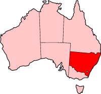
New South Wales location - (from en.wikipedia.org)

|
Ez a fájl szabadon másolható, terjeszthető és/vagy módosítható a GNU Szabad Dokumentációs Licenc feltételei alapján, az 1.2 vagy későbbi, a Free Software Foundation által publikált Nem Változtatható szakaszok, Címlapszövegek és Hátlapszövegek nélküli változat szerint. E licenc egy példánya a GNU Szabad Dokumentációs Licenc című fejezetben olvasható. |
| Ez a fájl a Creative Commons Nevezd meg! – Így add tovább! 3.0 Unported licenc alapján használható fel. | ||
| ||
| Ez a licenc a GFDL licenccsere során került a fájlra. |
Fájltörténet
Kattints egy időpontra, hogy a fájl akkori állapotát láthasd.
| Dátum/idő | Bélyegkép | Felbontás | Feltöltő | Megjegyzés | |
|---|---|---|---|---|---|
| aktuális | 2004. november 27., 05:24 | | 200 × 186 (11 KB) | Jeroen | New South Wales location - (from en.wikipedia.org) |
Fájlhasználat
Az alábbi lap használja ezt a fájlt:
Globális fájlhasználat
A következő wikik használják ezt a fájlt:
- Használata itt: de.wikipedia.org
- Használata itt: en.wikipedia.org
- Ghin-Doo-Ee National Park
- Goulburn River National Park
- Mount Royal National Park
- Towarri National Park
- Wallingat National Park
- Watagans National Park
- See Change Festival
- Swansea, New South Wales
- Australian south-east coast drainage division
- Come By Chance, New South Wales
- Lake Burrendong
- Highways in New South Wales
- Bonshaw, New South Wales
- Shellharbour, New South Wales
- Goolmangar, New South Wales
- Pilliga, New South Wales
- Tooraweenah
- Woodenbong
- Exeter, New South Wales
- Western Division (New South Wales)
- Tarana, New South Wales
- City of Queanbeyan
- Medlow Bath, New South Wales
- Lake Victoria (New South Wales)
- Wilsons Peak
- Belford, New South Wales
- Mount Hutton, New South Wales
- Clunes, New South Wales
- Goonellabah, New South Wales
- Muster (census)
- Southern Tablelands
- Mount Pleasant, New South Wales
- Narrabri Stellar Intensity Interferometer
- Valla, New South Wales
- Terry Hie Hie, New South Wales
- Milson Island
- Tallimba
- Perrys Lookdown
- Evans Lookout
- Nepean Gorge
- Shark Island (Cronulla Beach)
- Linden, New South Wales
- Capital Country
- Mororo, New South Wales
- Wonboyn Lake
- Horsley, New South Wales
- Cullen Bullen, New South Wales
- Pigeon House Mountain
A fájl globális használatának megtekintése