Fájl:Robinson Crusoe island.png

Az előnézet mérete: 800 × 560 képpont További felbontások: 320 × 224 képpont | 640 × 448 képpont | 818 × 573 képpont.
Eredeti fájl (818 × 573 képpont, fájlméret: 613 KB, MIME-típus: image/png)
|
Ez a fájl a Wikimedia Commonsból származik. Az alább látható leírás az ottani dokumentációjának másolata. A Commons projekt szabad licencű kép- és multimédiatár. Segíts te is az építésében! |
Összefoglaló
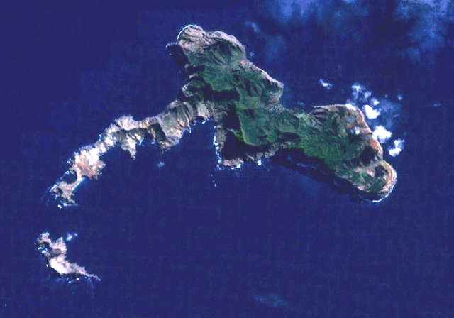
Robinson Crusoe Island (or Más a Tierra or Juan Fernandez island) and Santa Clara Islet (south). Town of San Juan Batista is on the northside. World Wind Landsat visual color.
Licenc
| This image is in the public domain because it is a screenshot from NASA’s globe software World Wind using a public domain layer, such as Blue Marble, MODIS, Landsat, SRTM, USGS or GLOBE.
|
 |
Fájltörténet
Kattints egy időpontra, hogy a fájl akkori állapotát láthasd.
| Dátum/idő | Bélyegkép | Felbontás | Feltöltő | Megjegyzés | |
|---|---|---|---|---|---|
| aktuális | 2006. március 10., 17:26 | | 818 × 573 (613 KB) | Rasbak | brighter picture |
| 2005. szeptember 30., 00:27 |  | 818 × 573 (626 KB) | Hardscarf | Robinson Crusoe Island (or Más a Tierra or Juan Fernandez island) and Santa Clara islet (south). San Juan Batista is on the northside. World Wind Landsat visual color. Category:Chile Chile {{PD-WorldWind |
Fájlhasználat
Az alábbi lap használja ezt a fájlt:
Globális fájlhasználat
A következő wikik használják ezt a fájlt:
- Használata itt: arz.wikipedia.org
- Használata itt: ast.wikipedia.org
- Használata itt: az.wikipedia.org
- Használata itt: ceb.wikipedia.org
- Használata itt: de.wikipedia.org
- Használata itt: en.wikipedia.org
- Használata itt: es.wikipedia.org
- Használata itt: et.wikipedia.org
- Használata itt: eu.wikipedia.org
- Használata itt: fa.wikipedia.org
- Használata itt: fr.wikipedia.org
- Használata itt: he.wikivoyage.org
- Használata itt: hr.wikipedia.org
- Használata itt: it.wikivoyage.org
- Használata itt: ko.wikipedia.org
- Használata itt: nl.wikipedia.org
- Használata itt: nn.wikipedia.org
- Használata itt: pl.wikipedia.org
- Használata itt: ru.wikipedia.org
- Használata itt: sv.wikipedia.org
- Használata itt: www.wikidata.org
- Használata itt: zh.wikipedia.org