Fájl:Los Alamos Tech Area Map.jpg
Nem érhető el nagyobb felbontású változat.
Los_Alamos_Tech_Area_Map.jpg (600 × 302 képpont, fájlméret: 46 KB, MIME-típus: image/jpeg)
|
Ez a fájl a Wikimedia Commonsból származik. Az alább látható leírás az ottani dokumentációjának másolata. A Commons projekt szabad licencű kép- és multimédiatár. Segíts te is az építésében! |
Összefoglaló
| Leírás |
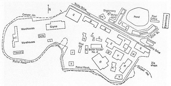
English: Map of Los Alamos Tech Area c. 1945 |
| Dátum | körül |
| Forrás | https://www.osti.gov/opennet/manhattan-project-history/Resources/photo_gallery/tech_area_large.htm |
| Szerző | Los Alamos National Laboratory |
| Engedély (Fájl újrafelhasználása) |
This information has been authored by an employee or employees of the Los Alamos National Security, LLC (LANS), operator of the Los Alamos National Laboratory under Contract No. DE-AC52-06NA25396 with the U.S. Department of Energy. The U.S. Government has rights to use, reproduce, and distribute this information. The public may copy and use this information without charge, provided that this Notice and any statement of authorship are reproduced on all copies. Neither the Government nor LANS makes any warranty, express or implied, or assumes any liability or responsibility for the use of this information. |
Licenc
| This image is a work of a United States Department of Energy (or predecessor organization) employee, taken or made as part of that person's official duties. As a work of the U.S. federal government, the image is in the public domain.
Please note that national laboratories operate under varying licences and some are not free. Check the site policies of any national lab before crediting it with this tag.
|

|
Fájltörténet
Kattints egy időpontra, hogy a fájl akkori állapotát láthasd.
| Dátum/idő | Bélyegkép | Felbontás | Feltöltő | Megjegyzés | |
|---|---|---|---|---|---|
| aktuális | 2017. február 11., 23:35 | | 600 × 302 (46 KB) | Hawkeye7 | User created page with UploadWizard |
Fájlhasználat
Az alábbi lap használja ezt a fájlt:
Globális fájlhasználat
A következő wikik használják ezt a fájlt:
- Használata itt: ar.wikipedia.org
- Használata itt: en.wikipedia.org
- Használata itt: ja.wikipedia.org
- Használata itt: uk.wikipedia.org